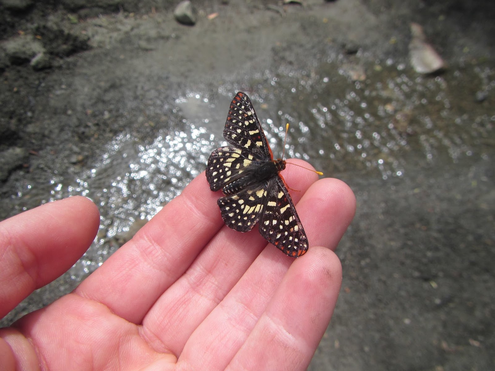
Short Summary: So far this has to be my favorite close backpacking trip. It was COLD but beautiful, plenty of water in May, and dog friendly!
Details
May 20
Day 1
Vivian Creek to High Camp
5.9 Miles
We drove up from Oceanside about 10:30AM, picked up our permits from the ranger station, and headed to the trail. When driving in you get to the Momyer Trailhead first so we pulled in to check it out before continuing to Vivian Creek. Once here we unloaded all our gear and Reecy and I sat at a picnic table. Jess drove the car back to Momyer, where we would be finishing, and walked back to us about 2 miles. She also stopped at the store and got us some sandwiches! We ate, got loaded up with our packs, and started out! My pack is always much heavier when I have extra gear, food, and water for Reecy. My pack was a little over 35 pounds! Good training. We made it up to halfway camp in about 2 hours and had a snack and rested for a bit. We then climbed for about 2 more hours and got to our camp for the night. Scouted around for a spot and set up camp. We filtered water, ate dinner, and watched the sun set. There were quite a few people up here but we were pretty far away from anyone else. It was getting cold very quickly and we didn’t hang out very long outside of our tents. I had Reecy’s sleeping bag which I was very thankful we wouldn’t be sharing this time. It is a normal sleeping bag that is synthetic, light, and pretty compact. There are more details on my gear page. I used Musher’s Secret on her paws this morning and put a little more on now as we lay in the tent. I am not sure if it helps a lot but will be testing it out. I love listening to her snore and having her along with us. It makes my trips that much better.
May 21
Day 2
High Camp to San Gorgonio Summit to Saxton Camp
10.3 Miles / 16.2 Total Miles
Today felt a lot longer than 9 miles. We didn’t get started until about 9:45 which is pretty late. We had breakfast, dug cat holes (I wish Reecy could learn to shit directly in it), packed up, and cleaned up camp. As soon as we started out we were climbing up switchbacks. We took breaks often and could really feel the weight of our packs. At one point when we were looking across towards another climb and the summit I decided that we could drop off our packs at a junction about .3 from the summit and take the essentials to the peak. This was a little help in the motivation factor. There were quite a few people on the trail and many of them with small day packs. That sounded like a better idea. We dropped our packs, grabbed warm clothes, cameras, and snacks and headed to the peak. Even with the elevation without our packs we felt like we could run. We made a few little detours to avoid a bit of snow and made it to the peak! Signed the book and took our pictures! It was awesome to be at my highest point so far and for Reecy to be there too.
It was windy and cold so we didn’t hang out too long. Headed back down, loaded up our packs again, and headed down the other trail to Saxton. This trail was very different. We didn’t see anyone else hiking for the majority of the time and there was quite a bit of snow. We did not need any gear to get across but were still very careful. Sometimes it was hard to know if we were still on the trail or just following random footprints. We took a break for my favorite lunch, tortilla with Hummus, cheese, and sausage at dry lake camp. I am pretty glad a messed up and got 12 boxes of powdered hummus when I thought I was getting 12 servings. After about a mile or so we started down switchbacks. At one point I missed a turn and we got off track for a bit before we had to go back and look at the map and get back on track. These 5 miles seemed very long today. We stopped and filled one bottle of water at a creak crossing before getting to camp and continued quickly. The sign for Saxton was VERY high in the tree and I am glad that Jess saw it. The camp was really pretty and we were the only ones here. I asked Jess where she wanted to set up and she said right beside me even though we had the place to ourselves. We got set up and I went to investigate how the next water source would be. It was down the hill likely less than a mile away and I met a couple guys filtering water there as well. They were asking how much farther until camp and seemed very excited when I said it was so close. I got us some water and headed back up. We got cleaned up and had dinner. I brought along a chocolate bar and we shared with the guys. They saw I had the bear can with me and asked if they could put their food in there for the next day. I am not sure if they were planning or hanging it or if they even had anything so it is a good thing I had room. It gets cold so quickly none of us hung out very long before crawling into our bags. It is only 8:30pm now as I write and I am listening to Reecy and Jess snoring already. I guess it is time to join them. Good night.
May 22
Day 3
Saxton Camp to Momyer Trailhead
7 Miles / 23.2 Total Miles
We were pretty slow again this morning. We found a patch of sun and moved over there to have our breakfast and filter our water. It took us a bit to get packed up and we started to head what we thought was going to be all downhill today. There were a lot of places to get water so we didn’t have to carry much which was really nice. This side of the trail was so different than going up Vivian Creek and I loved the loop rather than going the same both ways. There were many wildflowers including many of my favorites – Lupines! I was surprised at the many uphill areas. Also once we got to Momyer Creek we couldn’t find a great place to cross so we just walked straight through it and then the large hill up to the car. I think this loop was the better direction to go but I think going to Saxton on a quick overnight would be a good getaway, training trip, or gear shakedown.
This was one of the hardest hikes I have done. Backpacker Magazine list it as the 5th hardest hike however I am not sure that the other ones listed are really a "day" hike. The elevation gain was about 11,000 feet. It was just over 20 miles and I completed it in 11 hours and 50 minutes!
We started at 5:10 am from the Palm Springs Art Museum, Elevation - 500 Feet.
In the first mile I was already nervous if I was going to be able to make it. There were a few scrambling parts but a lot of climbing. There are a few different trails/paths but we followed the white dots for the most part going up. We got to the first set of picnic tables and I thought that they would have been farther along. The sunrise was beautiful and there were a few times I stopped to enjoy it - and catch my breath.
Going up a little farther we hit rescue box 1. We passed a lot of people on the trail and a few of them looked like they already needed to turn around at this point.
I tried not to stop much and continue with my slow pace even if it meant not taking much of a break so I could try to not fall too far behind the group. Ever couple of miles they would be waiting for me. Right before Rescue box 2 we all stopped and I had to have a larger snack. I was already feeling it and knew that the next couple miles were the most challenging.
It seemed like I would take 20 steps and have to stop so my head would stop pounding. I finished the water in my camelback (3 liters) at this point and still had a little Gatorade and spare 1 liter water bottle left. These were both frozen solid the night before and had melted all the way but were still cold and heavenly! At one point I soaked my hat with water to try to cool off. We had beat the heat for the most part but at times the sun was blazing.
In these last two miles, I had many thoughts that I would bail at skyline and just call it a day.
I was wondering how much father I had to go as I sat for another break, when I got called on the radio asking where I was. I wasn't really sure how to answer, so when he describe the large slab rock and said I only had about 15 more minutes I was excited! Once to the top of skyline, it was still questionable if I really wanted to continue but I gave myself a turn around time and decided to go for it. We got the permit (free and you fill it out) from the ranger station and they were talking about a rescue they had to do on the skyline trail. By the sounds of it this is very common. The main thing with the skyline trail is at some point you need to continue up rather than going down even if you feel like you cannot continue because of the heat. At the base on the day we hiked it was 94 degrees. If you hike down you are more likely suffer due to the heat.
We refilled our water and two of the guys decided they were done for the day and headed to the tram and home (it didn't sound like a bad plan). The 5 of us continued on.
It wasn't long and I had fallen behind again. Once I got to round valley they were waiting for me. It was always nice to see them and I tried to judge how much slower I was. I said hi and continued walking before they got up so I could get a little ahead. They caught up quickly and continued at a pretty quick pace. It was motivation to keep going knowing that they would be waiting.
Once I was almost to the peak I heard the radio again and they said they would wait for me for a picture because I was pretty close! I was happy I made it before the turn around time I set in my head. I had my lunch, took our pictures, and we headed back down.
Once I knew I was close to the 12 hour mark I started to walk a little quicker. My original goal was anything under 13 hours but it was awesome to be under 12 hours!
I am super happy that I completed this trail and I am not sure that it is one that I would want to do again!
Day 1
May 5
Havasupai Campground
Distance today = 12
Last night I left Oceanside about 6pm and headed to Temecula to pick up Beth. We had a couple very short stops for gas and to switch drivers. We made it to the trailhead about 1:30am on the 5th. The drive was actually not bad. Once we got to the last 60 miles we had to take it a little slower because of all the animals, elk, deer, jackrabbits, and cows! It was really cool and I wish we would have been able to get some pictures. We got parked and somewhat comfortable. I was able to sleep for a couple hours. The rest of the group found us about 5 and we got up and started to get ready with the sunrise.
I found Kathryn and woke her so she could get ready. We started on the trail about 5:30. The sunrise was beautiful! The trail was mostly downhill and very easy. I could tell my pack was a little heavier than normal (extra clothes, snacks, and drinks). We made it to the point to check in about 9:30am. We all had to pay here for the reservation entrance fee and camping fee. Our total for 3 nights was $100/ person.
On the way to camp there was water flowing on the side of the trail. It was really neat to see. Then we came up on Little Navajo falls. It was really pretty and we stopped for a second to take it in before continuing to find camp. The next large waterfall was Havasu Falls! This was incredible! The water was so blue and like nothing I had ever seen before! Someone found a large camp area pretty close to the water and we set up camp. We changed into swimsuits.
We went to Havasu Falls and played in the water! It was very cold but there is no way to not enjoy it. I brought my DSLR camera and played around with taking pictures and found a couple little frogs. After a few hours we started to get hungry and decided we needed lunch and possibly a nap! When the three of us got back to camp almost everyone’s tents were gone! It was extremely windy and ours were still in place but they were not looking so great. We were told they relocated farther down the river to a spot a little more protected from the wind. We packed up and moved again. Gave us all a little more practice on getting our tents set up.
Once we got set up again, we had lunch, filtered water, and rested for a bit. We saw some people walking back to their camps with fry bread and were excited to go try some! Kathryn and I shared one with honey and powdered sugar on it. It was amazing and it is a good thing it doesn’t look super easy to make. We were ready to explore a little more! We headed to Mooney Falls. I am not really sure what I was expecting but it seems like it kept getting better. It is a bit of an adventure to get to the bottom of the falls with ladders and chains. Everything was a bit damp and slick because of the waterfall. Once to the bottom we all went exploring around and I
played with my camera a bit. We stayed until the sunset over the fall and headed back up which was much easier than going down. I could see how this part would be a little scary but thankfully climbing helps with those fears. Once back at camp we cooked and all hung out around the table. I am really excited to explore tomorrow and hoping I can convince some people to go all the way to the Colorado River with me!
Day 2
May 6
Havasupai Campground
Distance today = 16 (guessing)
Distance total = 28
Overall today was AMAZING!!!! I woke up pretty early and we all talked about our camp site. We were in a bit of a low area and the forecast had rain scheduled so we were a bit worried about water if it rained a decent amount. We were getting ready to head out on our hike for the day and found an amazing camping site. We went back and told the others and there we were moving again! Note for anyone going… hike pretty far into camp – at least past the second toilet before camping! The spots get more amazing as you go farther in.
So after getting moved, it was a pretty late start to make it all the way to the Colorado but I really wanted to. We had 6, Kathrine, Ryan, Keven, Kim, Eric, and me, of our group headed out to at least make it to Beaver falls. It was a beautiful hike.
We didn’t stop at Mooney falls because we had just been there the night before and that saved some time. I was wearing running shoes and socks and everyone else was in some sort of hiking sandals. I went to Mooney Falls in my sandals the night before and didn’t really love walking that far in them so went with something I knew I was comfortable in.
The hike to Beaver Falls wasn’t too challenging with a few river crossings that were a lot of fun. We decided to filter water and take a snack break at Beaver falls for a bit and everyone decided what they wanted to do. Two of our group decided to stay and enjoy the falls and we continued on to the Colorado. I am glad the others decided to go because I wanted to but didn’t really want to go alone. It was pretty flat to downhill most of the way with a few water crossings some up to my thighs. The water felt amazing each time we
had to cross and was a great way to cool off and enjoy the water! There was a ton of sharp brush we had to walk through and my legs were getting scratched quite a bit. Once to the Colorado it was really awesome to see the blue water meet the brown river. We sat here for a bit and had lunch and a break. We only saw a couple groups hiking from Beaver Falls to the Colorado and it was nice to be secluded for a bit in a very populated hiking area. The way back we made really good time and we were all super hungry! I mixed up my powered hummus and shared. I am really glad I found this mix. The only thing that could make this place better would be being able to sit around a campfire at night. It is pretty awesome to listen to the water flowing as you lay in your tent.
Day 3
May 7
Havasupai Campground
Distance today = 8 (guessing)
Distance total = 36
I wanted to see the sunrise today but the weather wasn’t having it. I still got up before the sun would have been fully out so I could enjoy the falls without a lot of people. I walked up to Havasu Falls and admired it for a bit before continuing to Navajo Falls. It was pretty chilly morning with a little drizzle. I had my rain pants, down jacket, and rain jacket with me! I sat on a rock that I had to go through the water to get to and had my breakfast! I took a few pictures and enjoyed the time alone. It was really beautiful. I really enjoyed it. I went into the village and got a snack and soda for later and explored the area a little more.
There were already people lining up to get their flight out. There were a lot of horses getting ready to pick up gear and people. I took my time getting back to the Camp about the time everyone was getting up. Everyone was just hanging out today since it was a little colder and raining off and on.
A group of us went exploring in one of the mines which was really cool. Beth and I went back to little Navajo Falls and followed it upstream to a larger fall. There was no one back there and it was really beautiful. On the way back to camp we stopped for Fry Bread! This stuff is way too good. I also got a nap in the hammock someone brought – which is an amazing idea because there are lots of perfect trees for them. This day was very relaxing.
Many people were planning on getting up at 4 to hike out to beat the heat and get home a little earlier so everyone was headed to bed pretty early. Even with colder weather and a little rain this place is incredible and I am already thinking of a way to make it back!
Day 4
May 8
Trailhead
Distance today = 10
Distance total = 46
Today we got up about 6 and started packing up. I think our time spent in Havasupai was perfect! I am really glad that we hiked in super early on the first day and had almost the whole day to play and relax. If…WHEN… I do it again I will try for the same amount of days.
We got everything packed up, ate breakfast, and started walking. It was a little sad to say bye to this beautiful place. The hike out was a little more challenging than in. The rest of the group all left as we were getting out of our tents so they could beat the heat. We were pretty good until the real climb out of the canyon. It was starting to get hot and isn’t a very easy climb. I am glad my pack was much lighter. Once almost to the top of the trail I hear my name. I am really confused who would know me. It was 2 of the girls from our trip who were waiting on one their bags because she paid for the pack mule to bring their bag up as a Mother’s Day gift for herself! Kathryn and Beth were pretty close behind and we all celebrated that we made it to the top.
They really know how to get a little additional money by having fresh fruit, frozen drinks, ice cream, and snacks at the top! We got some watermelon that was amazing! Took a few final pictures and got ready to start our drive home.
It wasn’t a bad drive. We stopped at Chipotle on the way home for a late lunch and I ate the whole bowl! It was delicious. I got home a little before 9pm. It was an incredible trip and I am excited to plan another trip for more friends and family!
Please help me out by subscribing to my YouTube channel!
Location: Oceanside
to Upper Uso Camp Ground Distance
traveled today: 0 Distance
traveled total: 0
It took about 6 hours to get to the campsite.Between traffic, stopping at Costco for
backup poles, bathroom breaks, and more traffic.The directions if you put in the address will
take you to the wrong place but if you just follow the roads/signs it is
easy.There is a little creek/river to
drive though in order to get to the camp ground and I stopped for a minute to
try to figure out how deep it was before crossing.We pulled in about 6:30 and found our
spot.It was right next to the bathrooms
but very private.The campground is
awesome.We went for a walk, set up our
tent, and made dinner.Got all my stuff
ready for the next day, and opened my new poles (a backup pair from Costco
because I have lost my normal ones).
I found out I really need to practice starting a fire
without a fire starter.I got a small
fire going but it didn’t last very long.It was okay because I was tired and ready for bed shortly after
sunset.Once in the tent I was a little
worried about Reecy because we could hear a lot of the people around.She sat very alert in the beginning but by
the time I got in my sleep clothes she was curled up on her bed and
snoring.I had a little jacket for her
just in case she got cold.I originally
set an alarm to try to get an early start but ended up talking myself out of it
and turning it off.
Date: April
23, 2015
Location:
Upper Uso Camp to Santa Cruz Guard Station Distance
traveled today: ~11 Miles Distance
traveled total: ~11 Miles
Our journey
started out on a dirt road and I wasn’t very excited thinking we were going to be
on the same dirt road as ATVs.After
about a mile the Santa Cruz Trail breaks off to a single track dirt path.There is a place to register however all the
pages were filled out and it looked like it was never looked at with a lot of
people writing random things.I decided
to skip this part.I made sure to watch
the time so that I could be sure to give Reecy enough water.We took a short water break about every 30
minutes and she was drinking a lot of water.It was already hot but thankfully there was a lot of shade.Once we got to the fields of yellow flowers
there was very little shade and getting pretty hot.This was around 5 miles.I kept saying we would take a longer lunch
break at the next shady spot but there wasn’t much.Reecy was starting to fall behind so I took
off her pack and attached it to my bag.She had already gone through the water she was carrying so it was pretty
light.When I did this I must have
dropped her water bowl or left it sitting on the rock.Thankfully one of the guys who I saw when we
first started came up when we were resting and had picked it up for us!I was super thankful.I had an extra one but of course love her
pink one!
Reecy was
tucking herself under a bush and so I took off my pack and sat under my
umbrella for a bit and waited for her to cool off.By looking at my InReachit said we were at mile 7… so I was thinking
we would have 3 more miles even though the map didn’t look like we would have
that long.What I figured out later
that night when I was reading the instructions is that my tracking was set so
it would only track every hour so it was doing a lot of straight lines and
missing a lot of what we hiked.We
really only had about a mile left to go!We got back in a tree covered area and it was all downhill to a creek
that we crossed to get to camp.It was
on these switchbacks we saw our 2nd person of the day, a girl who
was running to camp and all the way back in one day.She had dirt all over the front of her from
slipping on one of the areas where there was a lot of loose dirt.I thought she was crazy.Once at camp there were already 3 guys there
and the guy who picked up Reecy’s bowl, John.We choose a secluded spot that was next to John.Our two spot where farther away from the group
sites which was good because it looked like a small boy scout group came in
about 2 hours after we got there.Reecy
and I filtered water I was noticing how much poison oak was around.I avoided it as much as possible but think
this is where she brushed up against it.John came over and said hello and introduced himself.He was from Santa Barbara area and just
getting away for the night.We talked
about gear, he had a lot of fancy stuff – come to find out he was a doctor, and
our next trips.He would be doing part
of the JMT with his 19 year old twin kids this summer.He went back to his camp area and Reecy and
I rested in the shade watching the lizards.She didn’t successfully catch one.
I made
dinner for me and rehydrated some extra dog food Nature's Variety Instinct Raw. She approves of
this!Expensive but felt she most likely
needed the extra calories.
I was super
tired and watched the sun start to go down and crawled in the tent with
Reecy.She was on her bed and I was on
my sleeping pad and we covered up with my sleeping bag.We were nice and toasty!
Date: April
23, 2015
Location: Santa
Cruz Guard Station to Upper Oso Camp to home Distance
traveled today: ~11 Miles Distance
traveled total: ~22 Miles
I had an
alarm set so we could start before it got to hot.I hit snooze a few too many times.I started to pack up my sleeping pad and
change clothes and Reecy wasn’t moving much.She got up, took about 10 steps, went potty, and went back to her
bed.She was pretty sleepy.I made us both our breakfast even though I
wasn’t very hungry, I did enjoy my Starbucks white mocha mix!It didn’t mix perfectly and had little clumps
but still was delicious on the cold morning. Reecy was shivering so I put my down jacket on
her while I packed up the tent and the rest of the bag.John said bye and good luck on my JMT trip
and was off pretty quickly.I guess that
is a benefit of not having a tent that it takes less time to pack up.I am sure I will eventually get quicker at
it.Once everything was ready and
cleaned up, I took off another layer and Reecy’s jacket and was ready to go!The climb out of the camp was pretty
challenging.I forgot in just the one
night how many switchbacks there were.We stopped often to break.Once
to the top going around the mountain was easy and it was nice that it was still
shaded and much cooler than the day before.There was also a lot of cloud cover.We were alone for about the first 3-4 miles until we passed the 3 guys
who had left a bit before us.I got one
of them to take a picture of Reecy and I which was nice not to have to take a
selfie!We saw a lot more people today
on the trail than yesterday.About a
dozen or so mountain bikers… thankfully most of them had bells so we could hear
them coming.
We made it
back to the car – Reecy jumped in laid down and didn’t move.I tried to have her walk a bit and eat more
so she wouldn’t get to stiff. At the
very end of the hike she stepped on a sharp rock and hurt her paw, so I washed
that out and she didn’t seem great.I
checked her again and found a few more ticks that I removed.Once home I looked her over even more and
found 5 more ticks.I got them all out
but was still worried about her. I tend to worry about her more than
myself.
Poison!
Later that
night I started to notice a rash on the right side of my stomach and right
arm.It was super itchy and I knew I had
the dreaded poison oak.After a few
google searches to make sure that Reecy was okay I found that the oil can stay
in animal fur and transfer!Well… that
makes since because the majority of the places I had it was where we cuddled
together under my sleeping bag.I took
another shower and washed even more, bathed her, and started to wash everything
we may have touched.I was pretty miserable with day 3 being the worst.It has been over 2 weeks and I still can see
a color difference and wake up scratching in the middle of the night.I was really hoping I was the small percent
that doesn’t have a reaction.
Overview: I love
backpacking with Reecy.She is an
awesome trail dog and stays right behind me.She is super quiet and I ended up putting a keyring on her collar so I could
hear that she was still there and hadn’t stopped to take a break or go
potty.I would like to get a little bell
or something that jingles for when we hike.I also love her sleeping pad/bed Ruffwear Highland I got on REI’s outlet
one year.It is not super compact but
soft and helped keep her off the ground and a little warmer. I would like to get a bag that could be used
for her more and possibly double as my summer bag so we do not have to
share.
The trail
was really beautiful in the spring but would not attempt it in the summer
months.I cannot wait to do more trips
with Reecy!
25 days applying at the Yosemite Wilderness Permit to go Southbound – Unsuccessful Mt. Whitney lottery with 15 option days to go northbound – Unsuccessful
Applying to go Northbound from Horseshoe Meadows – Cottonwood Pass to
Yosemite visiting Mt. Whitney – SUCCESS!!!!!
I had an idea that the permit process might take some time but I had no
idea that it was going to be this bad. Once I have received multiple denied requests
for permits and was trying not to get to discouraged, I decided to apply for
the Mt. Whitney permit lottery.This
would start at the south end of the JMT and head north. It is not my ideal plan
because I would like time to acclimatize, end at the top of Mt. Whitney, and resupplying
would be easier but I feel like it may be my only option. The lottery permit
for Whitney was pretty easy to fill out and I could put down 15 different
options in 1 application so I felt pretty good about it.From the time the lottery closes until you
find out if you get it is 9 long days… to make sure the next plan will
work!I woke up and immediately checked
the recreation.org page to see if I had gotten my Mt. Whitney permit.As soon as I unsuccessful I pulled out my
laptop and found an available date for Cottonwood pass. Filled out everything I
needed, paid, and done!It was that easy
to get this permit.If you want to save
yourself some stress and time… just plan to go northbound from here!
So what’s next…
Start walking/backpacking more Do a rough plan of my miles/camps for each day Figure out food plan/resupply
I knew this would be happening this year and super excited I have a
plan!
This is likely the HARDEST decision I am making for this trip! I have the excel chart with everything that I think I need/want to take and likely some things I will want to drop off. Everything has its weight in ounces. There are very few things that I am extremely confident on.
Of course I have color coded my chart! J The main things I am pretty set on include: Sleeping bag, sleeping pad, down jacket, water purifier (with backup drops), my purple spork, shit shovel, umbrella, and headlamp.
I am planning a more weekend backpacking trips which should help me with my gear list and becoming more confident in what I have and the weight. I have a 3 day weekend every other weekend so I can get some decent trips! If you have any suggestions for where to go please let me know! I am always open to new places (especially if the permit is VERY easy to get or if one is not needed).
JMT has been in my head for a while. After backpacking in Yosemite last year, reading more books, blogs, and learning more, the JMT has become a mission and one of my bucket list items. I have decided I really want to do it solo. Mostly because it will be a major accomplishment and I enjoy being alone but also to be honest… I am not sure I could be on the trail with someone for that many days. There are so many factors…
how fast will I want to go one day, what time will I want to start, what if I just want to sit or take a dip in the lake, or if I am feeling good and want to do extra miles that day. I want to make all of those decisions by myself.
There have been SO many questions on my protection and the crazy looks I get when I say I am going solo. I often get asked if I am worried about the bears, the people, or the what ifs.
The only things that keep me up at night thinking are my feet and the weather. If you have ever hiked with me or seen my feet almost any day of the week then you know why. I get blisters and hot spots SO easily! I have tried different shoes, different socks, glide, moleskin, tape, and blister Band-Aids. The only thing that I have found to help is a combination of them all. Injini socks, the kind that go between your toes that I use to find SO annoying, prevent blisters between my toes – so they are a win. However, I still get blisters on the bottom of my big toes and heals on the inside and outside. So I typically do moleskin until it comes off due to sweat and then glide. I recently heard rubbing alcohol helps make the skin tougher… so yes I will be trying that. Any other suggestions are welcomed!
Then the weather! You can't control it, I am terrible at predicting it, and I am not a fan of thunder/lightning storms. So hoping there are not too many of these.
Planning this trip has become a little obsessive. Most of my free time and even some of the time that I should be working is spent:
Looking on blogs about what others did
Watching YouTube channels on people, girls, and anyone who has done it
Reading multiple of reviews on the “best gear”
Debating my pack situation
Debating my gear situation
Planning hikes I can do now
Calculating my “base weight”
Before any of this can really happen though I had to create a rough plan. I know I want to hike Southbound, meaning from Yosemite (ideally Happy Isles) to Whitney. So, how many days? To take or not to take zero (days with no hiking) or nero (days with close to zero miles) days? So this is about what I have decided. 18-20 days. Depending on how I feel will depend on the zero/nero days. Now that I know I want to do 20 days or less I need a plan A, B, and C. And the calculating begins. How many hours will I really need off work. Will I really want to get off the trail and being alone that long and come back to work at 100%? Last time after 5 days, the noise level in the office drove me nuts. I have decided if I can afford the time that I will plan a couple half days. Days to ease back into it. I would also love to be able to work with my Friday off work schedule. My schedule is awesome, but also doesn’t really do much good when you are taking off about 3 weeks. Plus, I will need the additional travel time to Lone Pine and to Yosemite. Then maybe a night in Lone Pine when I finish and then back to my house!
I figure I need about 133 hours of vacation time. On the day I am currently writing this – I only have 44 hours. I do the math for each week to figure out the EARLIEST I can do this trip is starting August 12th – but then I do not get an extra day off with Labor day holiday… so that pushes my start day would be August 18th. However, my ideal date would be for my permit on August 21st. I am really worried about getting a permit and starting too late in the season. In order to have the largest window of time to apply multiple days - I will be applying for my permit to start on August 15th. My ideal permit would be starting at Happy Isles with pass through. However, I am listing multiple trailheads are listed on my permit. I also need an exit of Donahue… which only 45 people get per day (which may sound like a lot but there are a LOT of people who do not get permits and all the exit permits are by reservations). From the Happy Isles group only 20 people per day get them. Because I am applying for only 1 spot I do have higher chances. I can also apply for the half dome permit with this… which I am not sure. I have done half dome 2 times already and it was awesome but at the same time I think I would rather try clouds rest (no extra permit required).
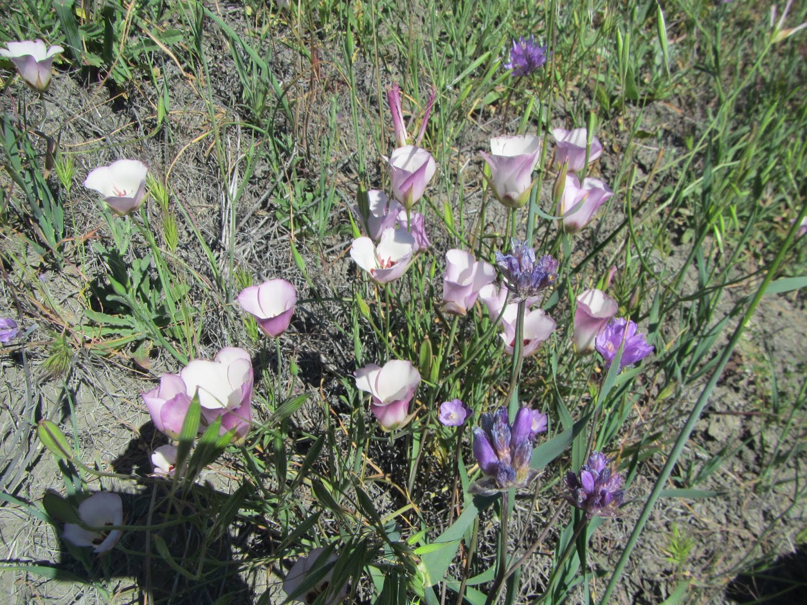
For now – I sit and wait. I will have all my permits filled out and ready to go for about 5 days and get ready to start the process!